New Zealand
Wellington floods: Record rainfall turns streets to rivers as warnings persist

Published by Sophie van Soest
20 Apr 2026
Wellington has been hit by record-breaking torrential rain, with flooding reported across several suburbs and parts of the central city in the early hours of this morning.
MetService says more than 70mm of rain fell between 3am and 4am - in just one hour alone.
Fire and Emergency New Zealand told RNZ it received more than 180 weather-related callouts in Wellington between 3.30am and 11am today, as emergency crews responded to flooding, slips, and property damage.
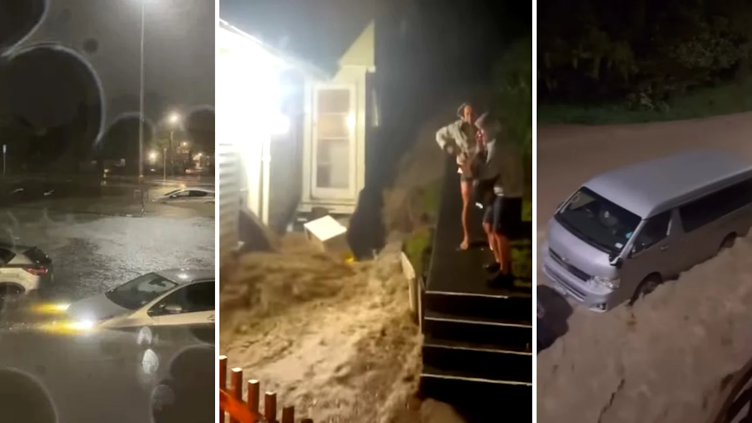
A video shared online shows brown floodwater rushing through a home in the Wellington suburb of Brooklyn, as it gushed out onto the street in the early hours.
Other footage from Mount Cook shows severe flooding pushing through Prince of Wales Park toward Salisbury Terrace.
In Mount Cook, council workers were even seen wading through neck-deep water this morning to clear blocked drains and help manage the flooding, according to 1News.
Residents have also shared images of submerged cars, landslides, and rockfall across the region.
Two states of local emergency were declared over the weekend for the Manawatū-Whanganui region for Whanganui District and Ōhura ward after heavy rain triggered flooding, slips, evacuations, and road closures. - This morning, at 9.04 am, Whanganui Mayor Andrew Tripe lifted the State of Local Emergency for Whanganui District.
In Tauranga, a tornado tore through Welcome Bay on Sunday, damaging homes and leaving more than 70 properties without power.
With more bad weather on the way, MetService is warning that the worst may not be over yet.
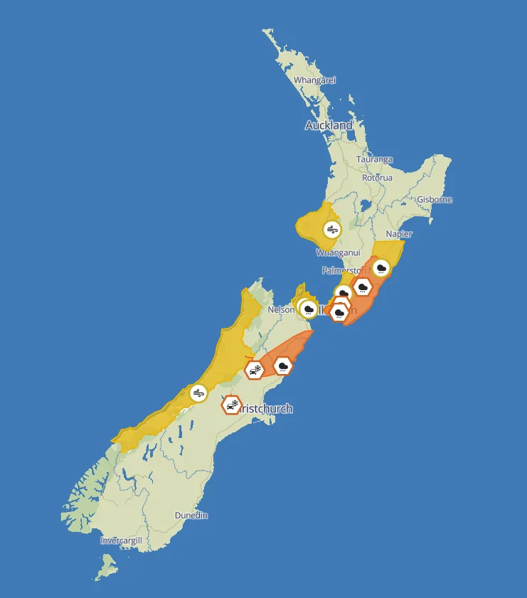
A complex low-pressure system is continuing to bring heavy rain and gale-force winds to the central regions of the county, with multiple warnings and watches in place.
Wellington, the Tararua Range, Wairarapa, and parts of the Kaikōura Coast are among the hardest hit, with some areas expected to see up to 250mm of rain in exposed ranges.
The expected heavy downpours are increasing the risk of rapidly rising rivers, surface flooding, slips, and dangerous driving conditions.
Further north and east, Hawke’s Bay, Horowhenua, the Kāpiti Coast, Porirua, and Marlborough are also under watches, where rainfall may approach warning levels.
Strong Wind Watches are also in force for several regions, including Taranaki, Wellington, the Kapiti Coast, Marlborough Sounds, and parts of the West Coast, with gusts potentially reaching severe gale in exposed areas.
NZTA's Regional Manager for the lower North Island and upper South, Mark Owen, said via RNZ: "With more bad weather to come, the ground already saturated, and more thunderstorms in the forecast, there is a real risk of similar incidents today and tomorrow. Drivers need to be ready for them.”
“Please drive cautiously when the weather is bad. A small mistake may have serious consequences. Take the time to ensure you get to your destination safely.”
"It is as simple as checking road conditions on our journey planner and keeping an eye on weather forecasts. If conditions are extreme, delay your journey until the situation improves,” he added.
"If you get caught out, not only do you put yourself in harm's way, but also those who may have to rescue you.”
MetService is urging people to stay updated with the latest forecasts, avoid flood-prone areas, and minimise travel while warnings are in place.
Published by Sophie van Soest
20 Apr 2026